On Friday, November 5th a lot of preceding work came together when I drove about an hour west from home to one of the newest Texas State Parks. Palo Pinto Mountains State Park consists of 4,871 acres of purchased ranch land just west of Strawn, Texas. The park will hopefully open to the public sometime in 2023 after construction is completed on roads, trains, campsites and a headquarters building.
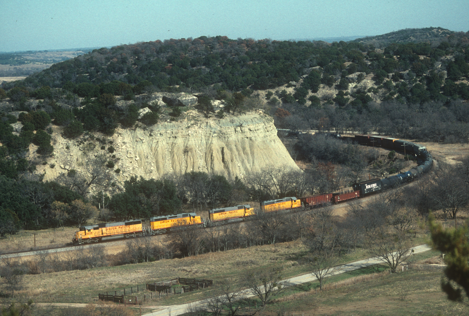
I had photographed trains here on the ex-TP, ex-MP now UP Baird Subdivision back in the 1990’s from ground level as exemplified by this scanned slide of train FWEP (Fort Worth to El Paso) taken on December 26, 1994 rounding the big curve around Cutoff Mountain next to Russell Creek.
Several years ago I once again climbed to the top of the ridge, but by then after 25 years the trees next to the tracks had grown tall enough so as to completely block the view of the tracks. Now I have my drone to overcome this obstacle, but the new wrinkle is that a person is supposed to have a permit from Texas Parks & Wildlife to fly a drone in a Texas State Park. As one who follows the rules I contacted TP&W and found the permit easy to obtain. Now it was a matter of waiting for ideal weather and coordinating with the park superintendent.
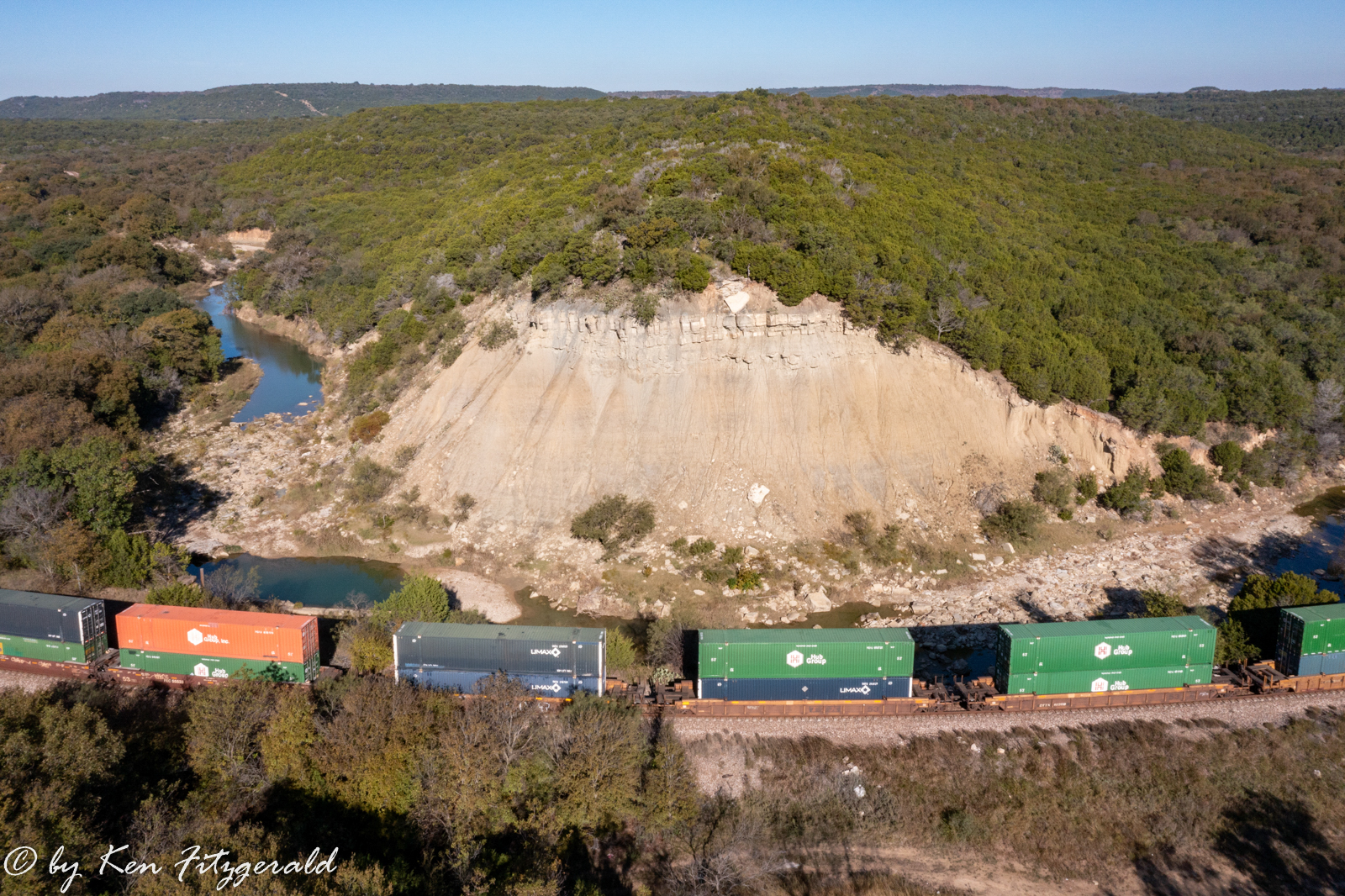
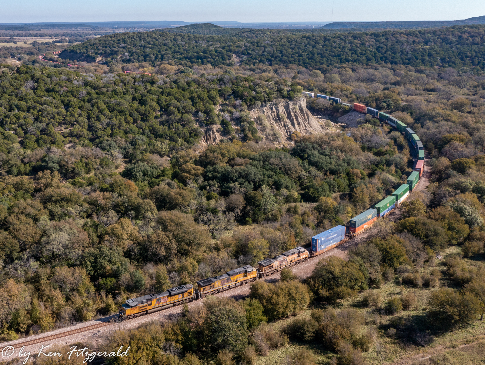
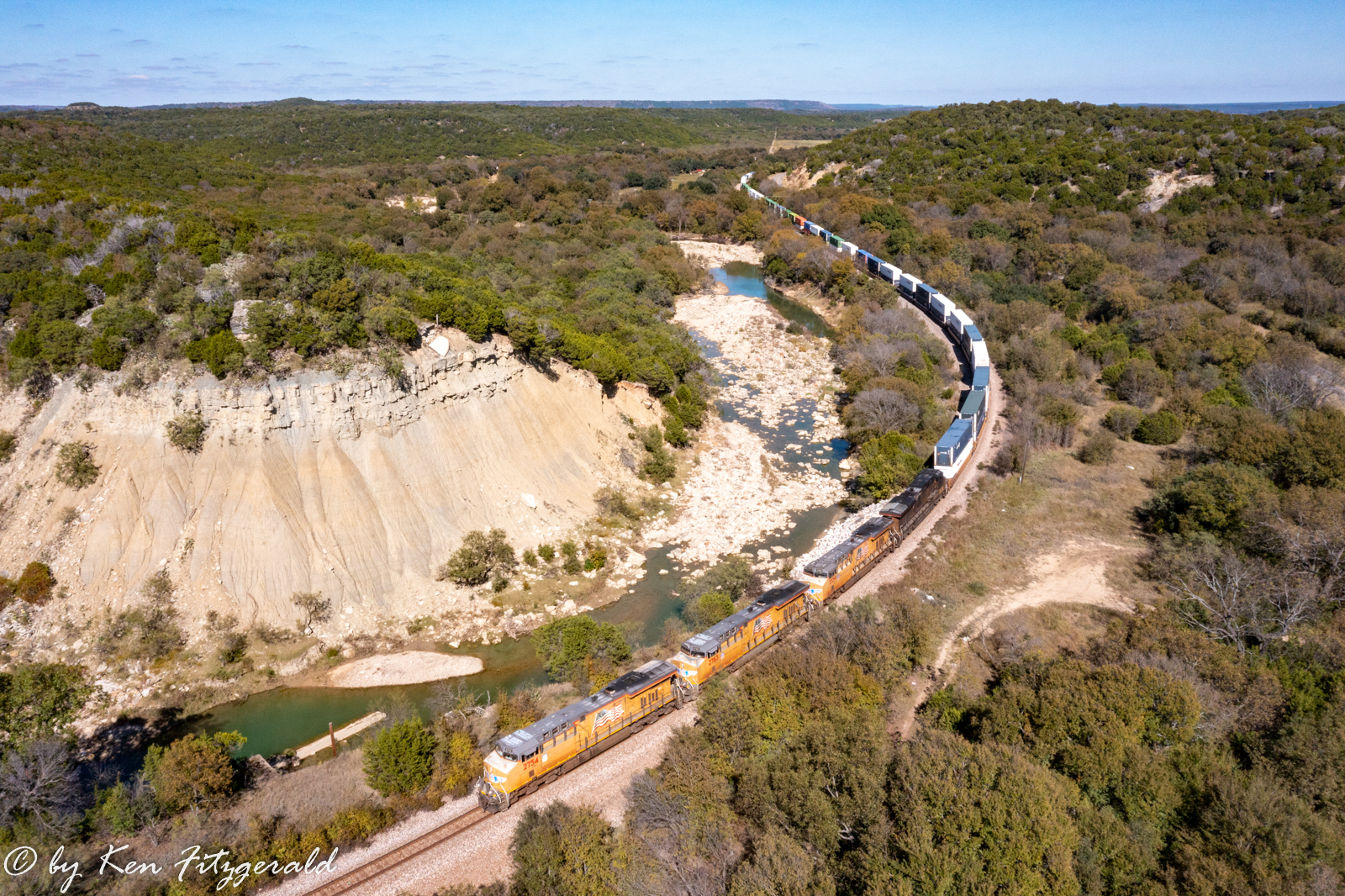
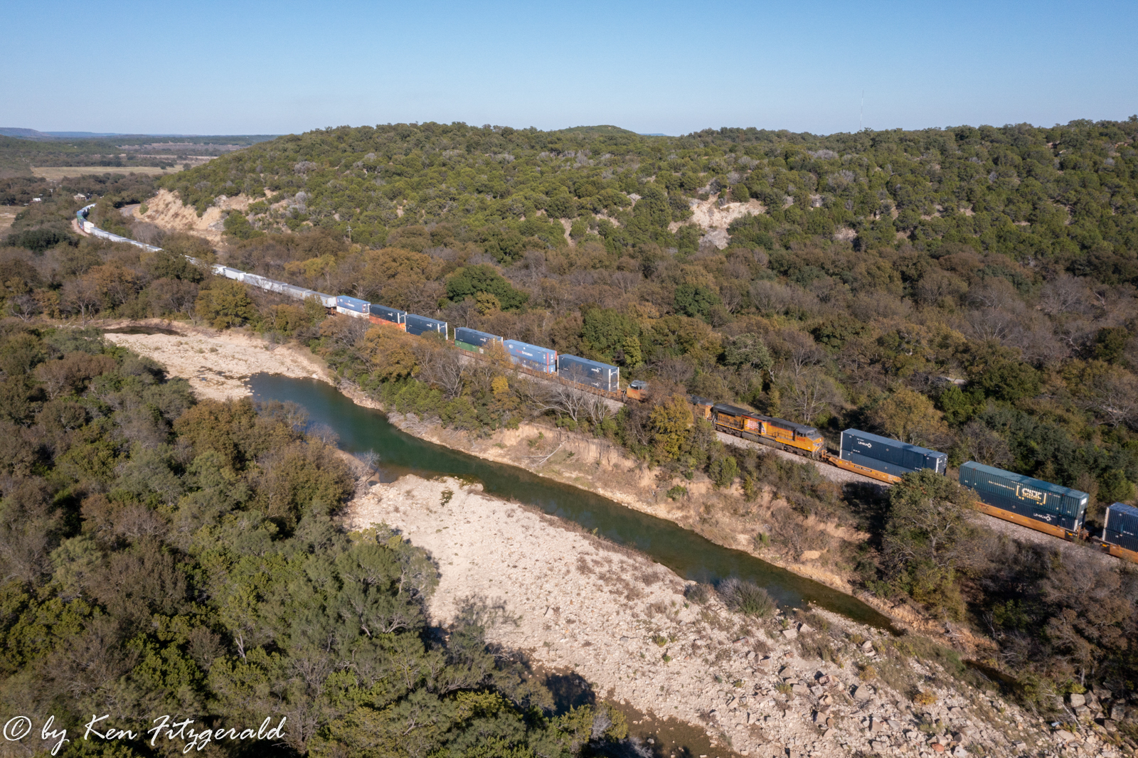
This all came together on November 5th, and at 10:27 am I was in position when the first train of the day a westbound intermodal rolled through the curves beside Russell Creek underneath what is locally known as Cutoff Mountain. This was a location where I would have little warning of a trains approach, and due to the tree line between the track and the road where I was launching from, I would not physically see any of the trains I caught this day. I almost missed this train as I thought I would hear the horn when it passed through Strawn about three miles to the west, but instead I heard the increasing rumble just in time to launch the drone and get into position.
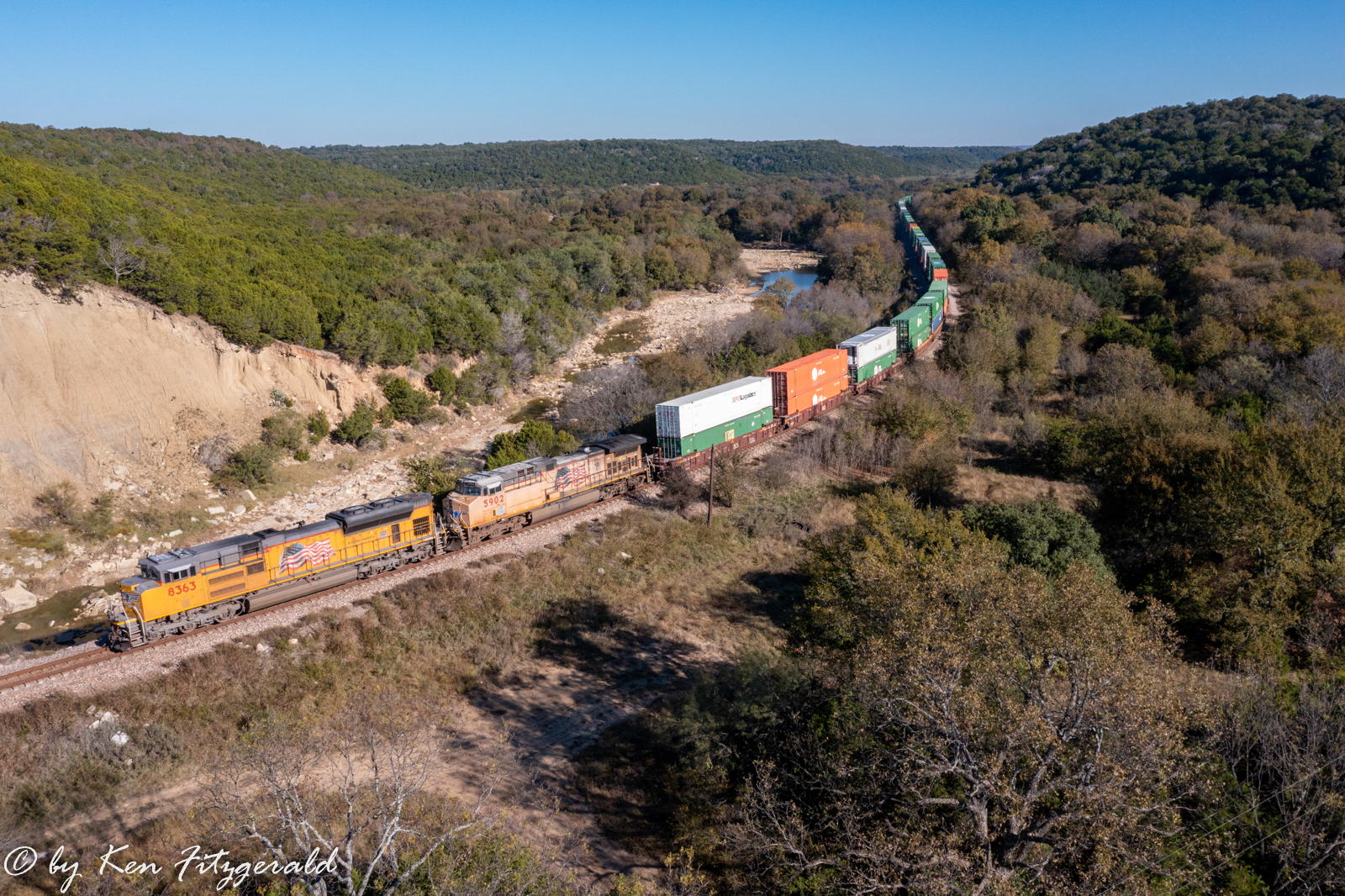
This was a long intermodal with two units up front and two DPU’s on the rear.
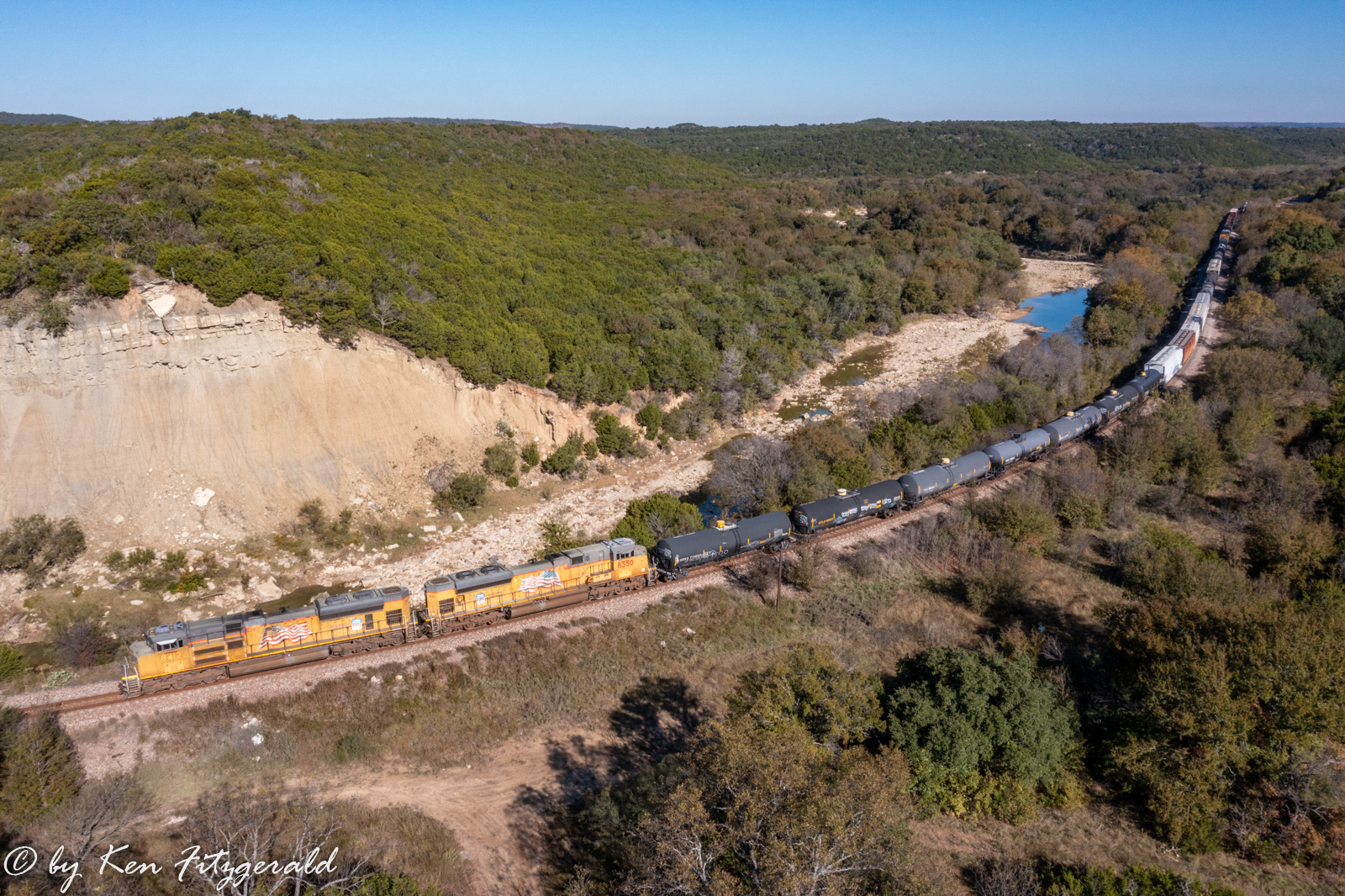
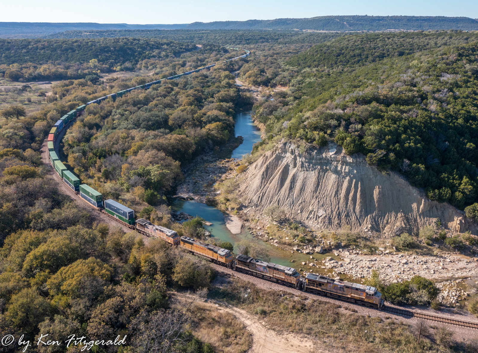
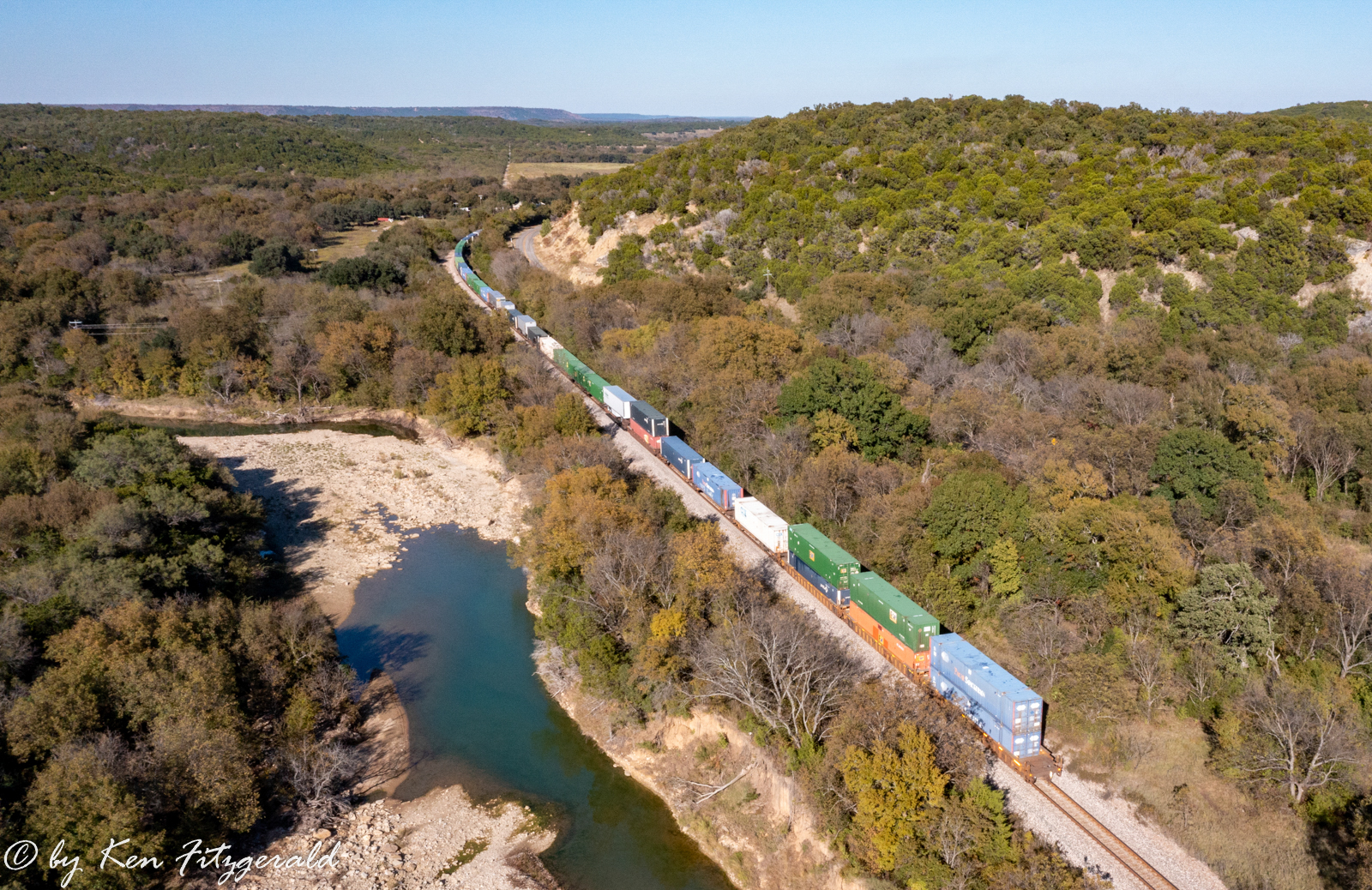
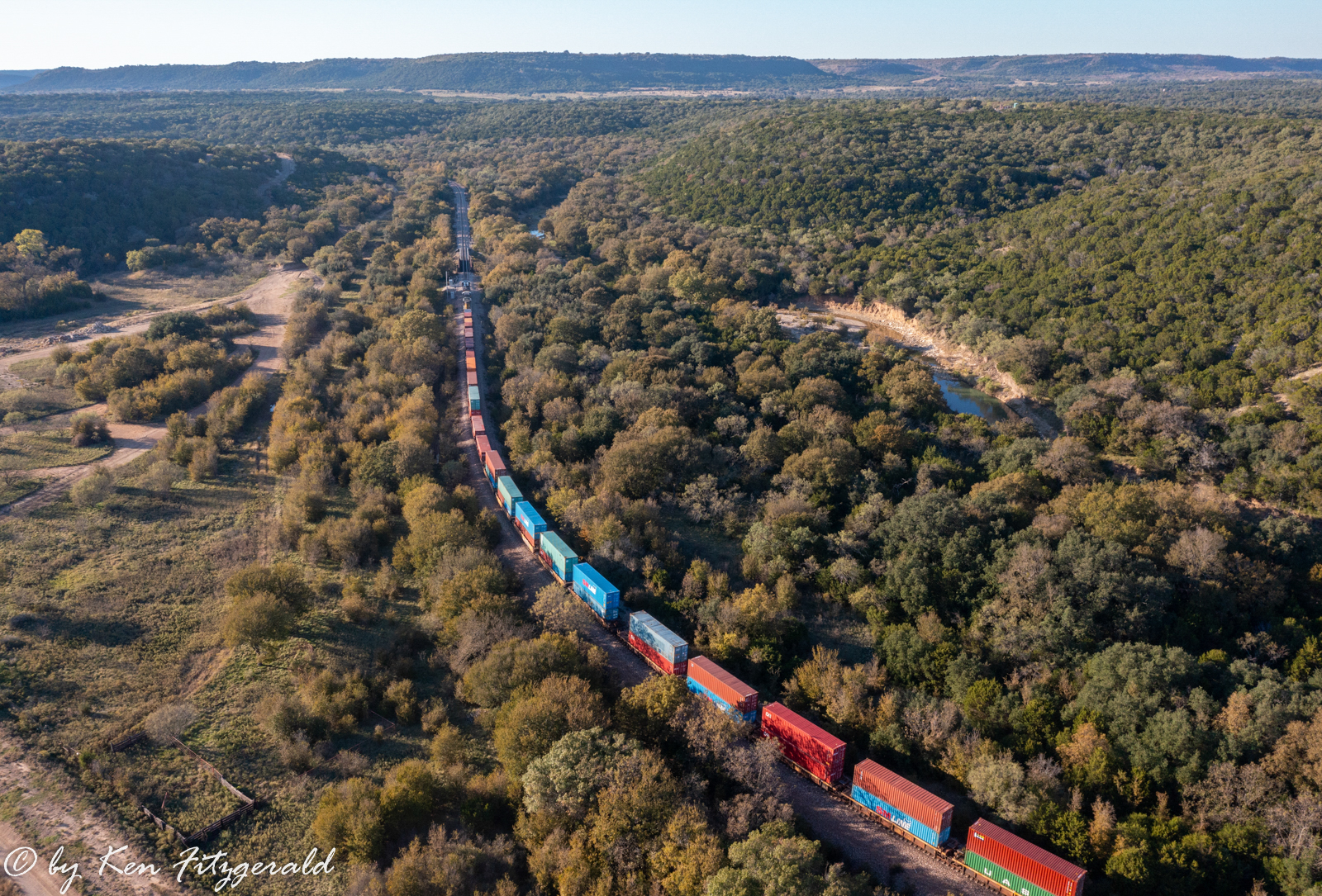
The second train was another westbound, this time a merchandise with two units up front and two mid-train DPU’s that passed by at 10:51 am.
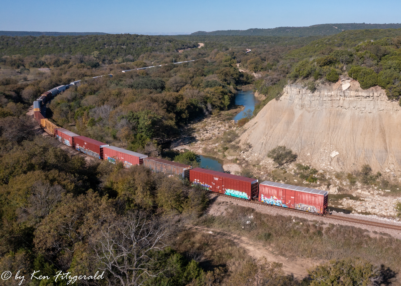
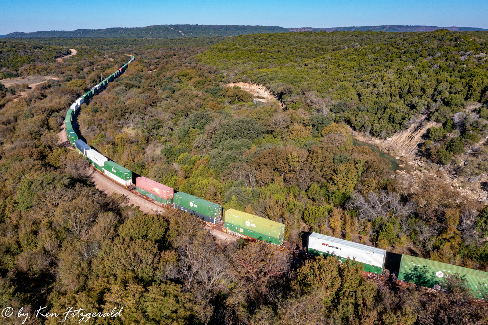
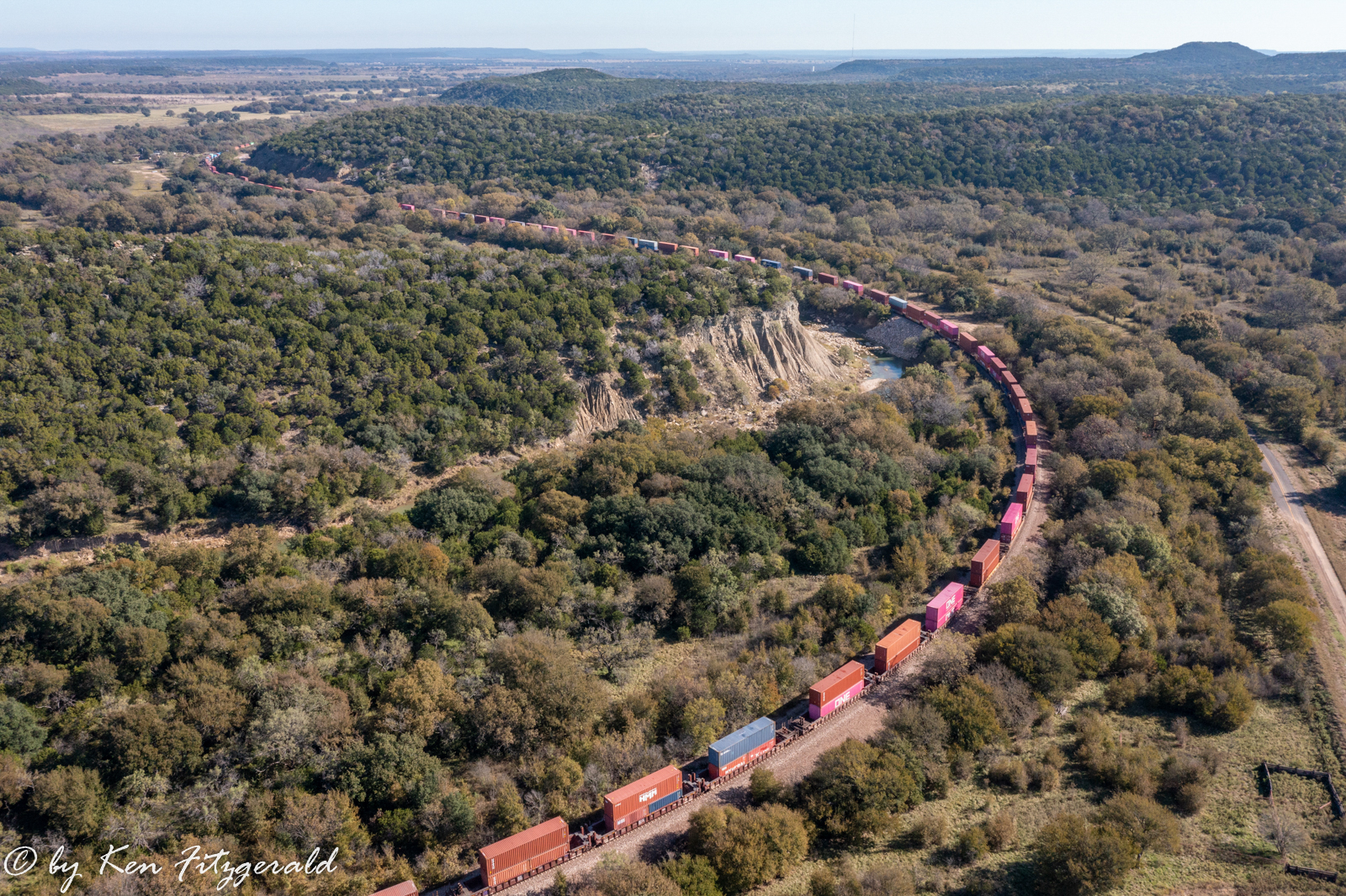
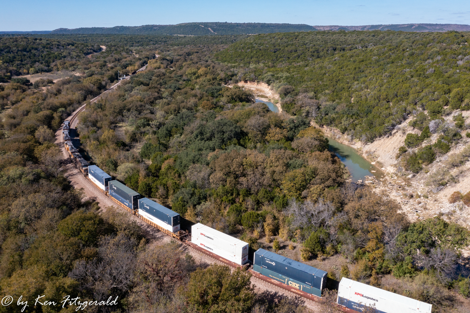
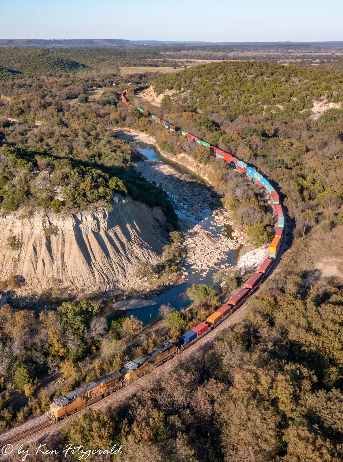
This procession of westbounds was continued by another intermodal train at 11:09 am. This time I took the drone up to nearly 400 feet to better see the train traversing the canyon by way of a big “S” curve. Strawn is in the background over the hills where a water tank and radio tower can be seen.
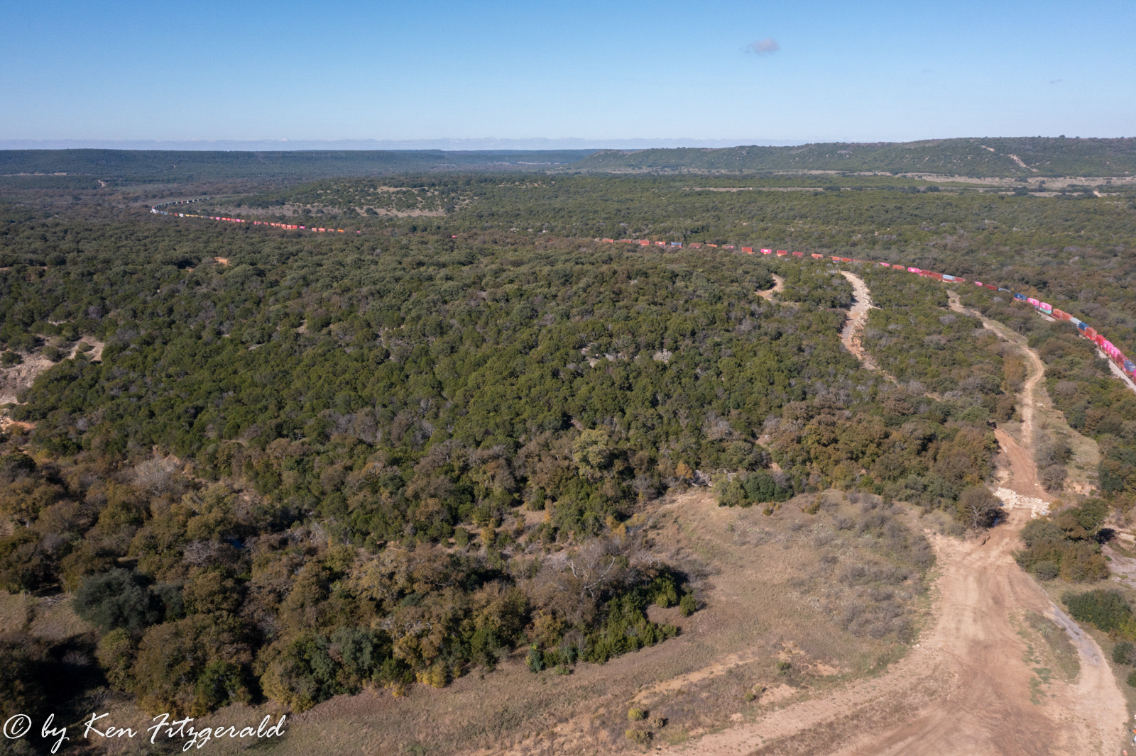
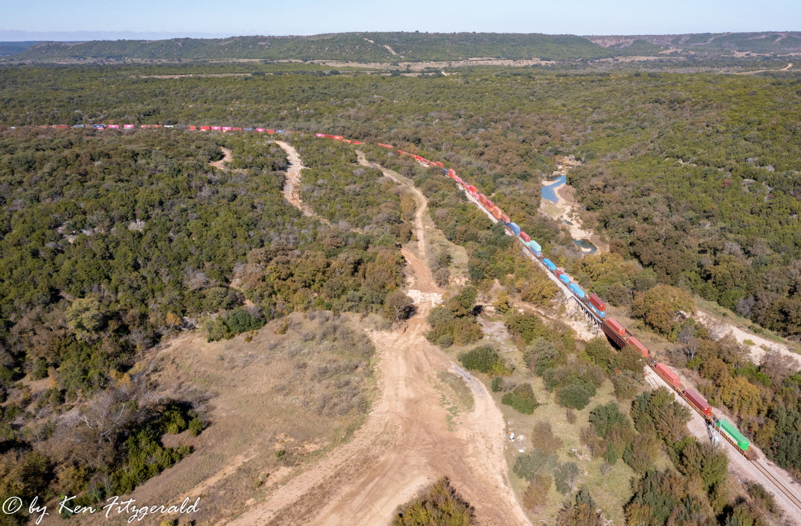
Now looking northwest you can see the line curve around and out of sight before it turns back to the west to climb Ranger Hill. You can also see some of the initial stages of road construction that will lead to part of the new campgrounds.
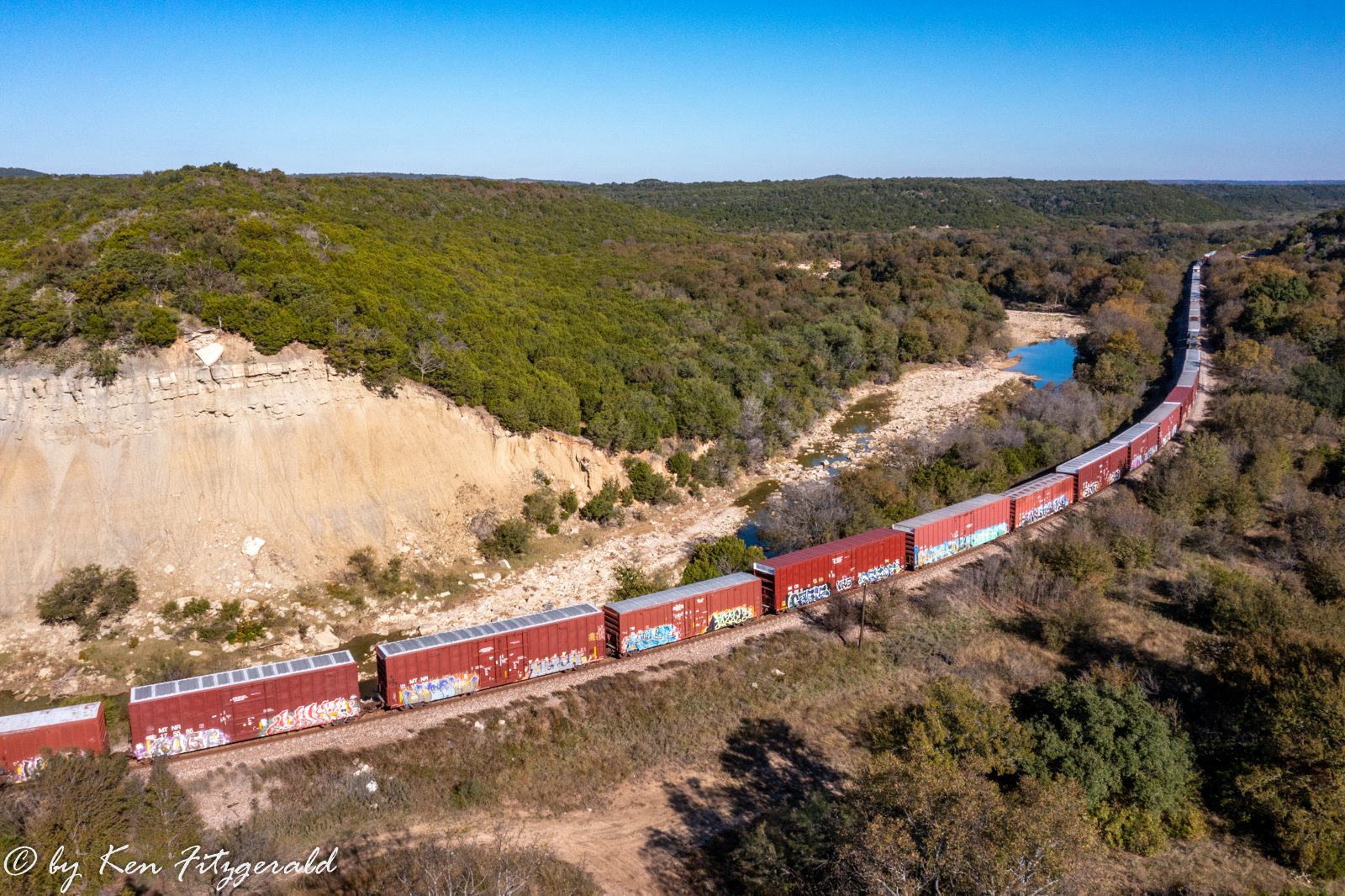
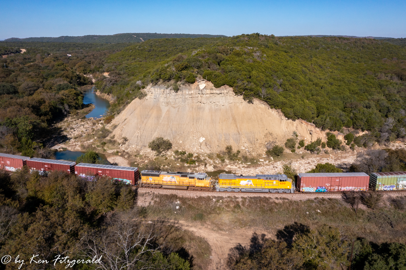
This intermodal had only three units up front.
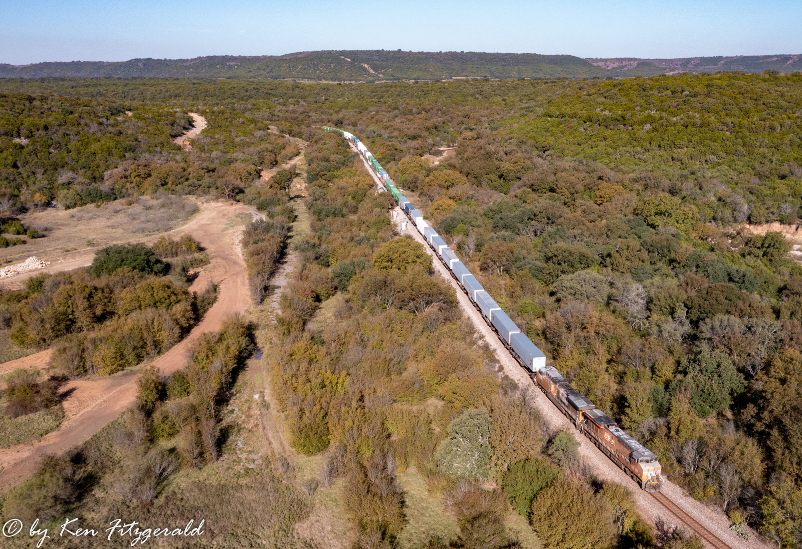
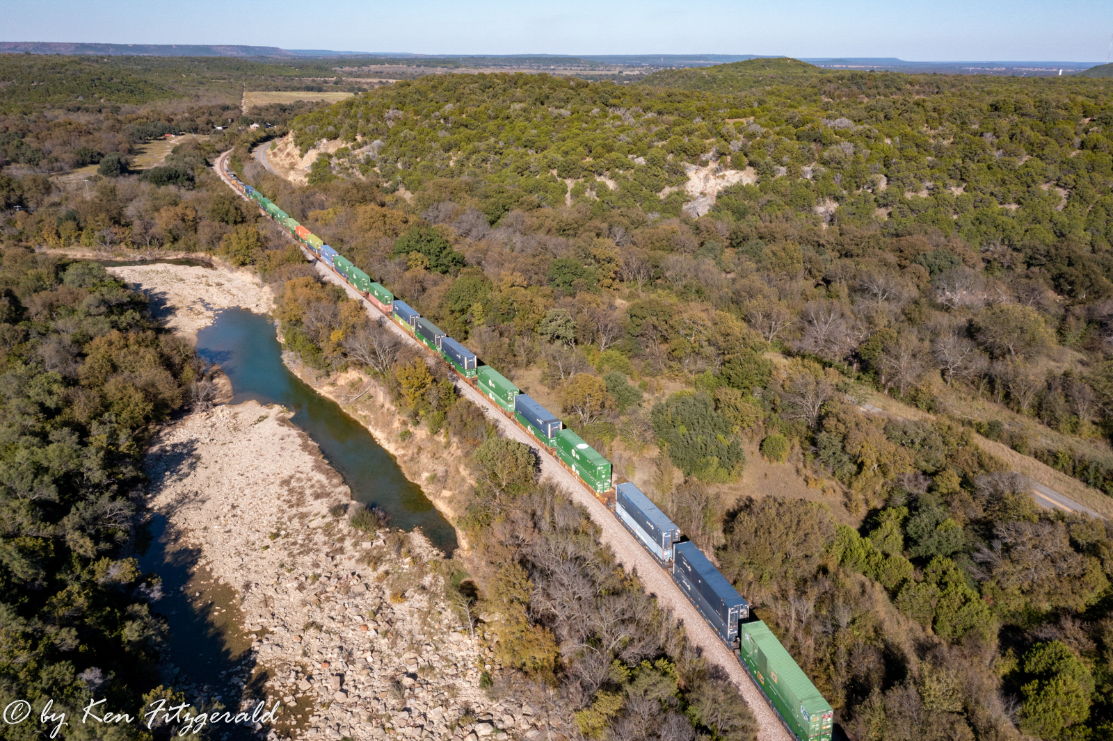
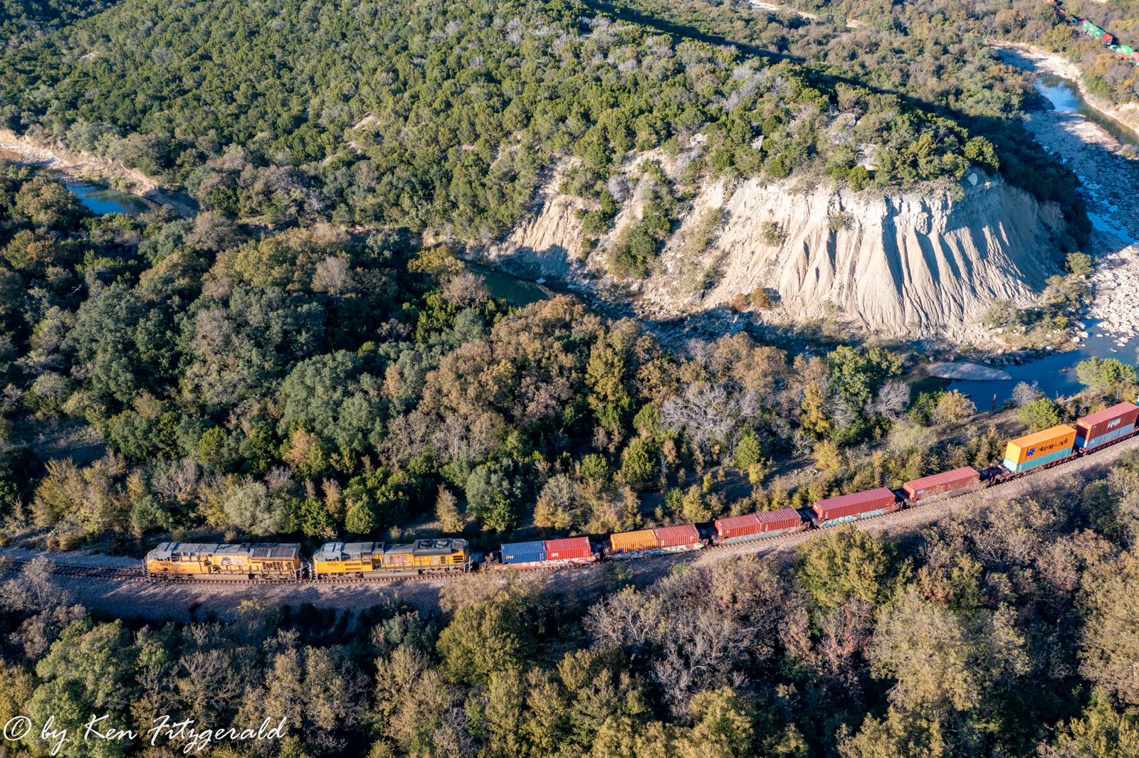
After this fleet of three westbounds there was a gap until the next westbound at 2:08 pm with four units up front.
The lighting for an eastbound train here would have been perfect in the morning but the first train heading in that direction did not show up until 4:09 pm so I had to make do.
My final train for the day came in the form of one more westbound at 5:14 pm and for this situation ther lighting was perfect. I cropped the drone’s obligatory horizontal scene into a vertical format for what I consider my best photo of the day.
Before I landed for the last time and headed home, I turned the drone south for a view looking towards Interstate 20 around 4 miles away across the wide open and rugged country that represents this area.

I appreciate the hospitality and assistance of the park service in getting these photos and I am sure I will be back!